Our Blog

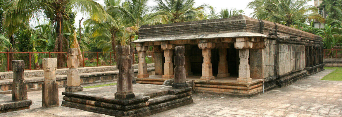
Jain Temple in Sulthan Bathery

Jain

Sulthan Bathery, the town and municipality in the Wayanad district of Kerala is an ancient historical place. It is believed by historians that Wayanad’s history is older than 3000 years. Chroniclers believe that the area was occupied during the times of early man. Sulthan Bathery

The town was known by many names before its present name, ‘Sulthan Bathery’. They are Sultan’s Battery, S. Bathery, Bathery, Hennaradu Vithi, Dodappan Kulam Mahaganapathivattam and Ganapathivattom. The town was known by another name, Kidananadu, due to the presence of the Kidangan tribes. Sulthan Bathery was also known by the name Purakizha during the time when the Kulashekara kings ruled.

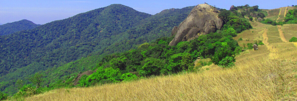
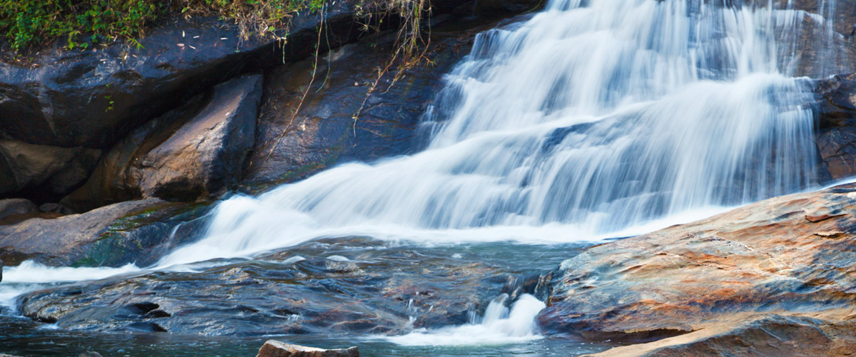
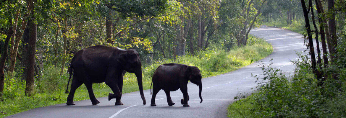
Sulthan Bathery is located at an altitude of about 930 metres above sea level. The climate in this region is very pleasant all through the year. This town is blessed by nature abundantly. One can view the beautifully folded hills across the horizon. Sulthan Bathery has National highway 766 passing through it, which makes this town the centre of tourist attraction. This town has become very popular among those belonging to India’s software valley, Banglore.

Read More

Pakshipathalam – The Abode of Birds

Jain

Wayanad, a land rich in greenery has many parts covered with evergreen forests. One can find a wide variety of wildlife here. Like the elephants, leopards, tigers, jungle cats, bison, peacock, and a wide variety of other bird species could be found here. Situated 1,740 metre above sea level and 7 km from northeast of Thirunelli is Pakshipathalam. It is about 32 km away from Manthavady, 66 km away from Kalpetta and about 78 km from Sulthan Bathery.

Pakshipathalam is situated on the Kerala side of the Brahmagiri Hills near Thirunelli. The Brahmagiri hill range lies in the border, between Kodagu (Coorg) district in the state of Karnataka and Wayanad district in the state of Kerala.

Also, on the Kerala side of Brahmagiri lays the famous Thirunelli Temple, which is believed to be built by Lord Brahma himself and dedicated to Lord Vishnu. The Thirunelli Temple is also known as the ‘Kashi of the South’ and also as ‘Sahyamala Kshetram’.

As the name suggests, Pakshipathalam has a rich collection of birds and so is an ornithologist’s paradise. The altitude, surrounding forests, rivulets and steep hills make it an ideal spot for trekking. The place has a cave; which is believed to be used by the ‘rishis’ (saints) for meditation during the ancient times. This cave is a major attraction among tourists. On the Karnataka side, this cave is known by the name ‘Munikal Cave’.

Read More

Meenmutty Waterfalls

Jain

Located on the Ooty main road in the Wayanad district of Kerala, Meenmutty Waterfalls is about 29 km away from Kalpetta. This waterfall is the largest waterfall in Wayanad and the second largest one in Kerala. This waterfall has a height of 300 metres and has the most spectacular and unspoiled natural setting. An interesting aspect of this waterfall is that it’s a three-tier waterfall. The water dropping from 1,000 feet flows through three layers.

The Meenmutty waterfalls are an excellent place to trek. During the dry seasons, one can get a closer look at the falls. But, during the monsoon season, getting too close to the waterfalls can be dangerous due to high water inflow. To reach the Meenmutty Waterfalls one has to trek through the jungle for about 2 km.

Since, the place is ideal for trekking; it is famous among adventure seekers. Providing picturesque views of nature, Meenmutty falls also attracts a large number of photo addicts. The best time to visit Meenmutty waterfall is from the months October to May. The waterfall is considered to be a dangerous spot, and so one must be careful while playing in the waters.

The name Meenmutty is a combination of two Malayalam words. ‘Meen’ meaning fish and ‘mutty’ meaning blocked. Thus Meenmutty is the place where fish gets blocked. Each tier of the waterfall has to be trekked separately.

Read More

Wayanad – Beauty Devulged

Jain

Wayanad

Formed in the year 1980 on November 1st, Wayanad is a district in north-east Kerala. It was formed as Kerala’s 12th district. It’s the only district in Kerala that borders both the neighbouring states, Karnataka (Mysore, Chamarajanagar and Kodagu (also known as Coorg) districts) and Tamil Nadu (Nilgiris district).Kalpetta is the district headquarters. Wayanad has three municipal towns, Kalpetta, Sulthan Bathery and Mananthavady. Unlike all other districts in Kerala, Wayanad has no town named after it. That is, there is no Wayanad town.

Wayanad district is located in the southern tip of the Deccan Plateau on the Western Ghats at an altitude ranging from 700m to 2,100m. This region was earlier known as Meyakshetra or Maya’s Land. Later, it evolved into Mayanad and then, finally into Wayanad. Folk etymology says that Wayanad evolved from “Vayal Nadu” wherein, “Vayal” meaning ‘paddy field’ and “Nadu” meaning ‘land’. The words together meant ‘the land of paddy fields’.

This district is the least populous district in Kerala with the largest number of tribal population. The major parts of this district are covered with thick forests. Therefore, it has many scenic places that attract many.

Read More